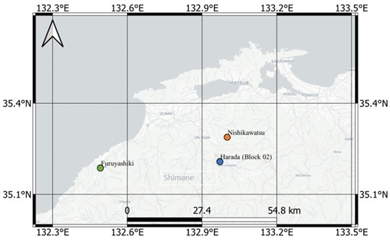
Map elaborated on QGIS for the phD research "Pot Shards". Three (3) Archaeological sites are indicated within the prefecture of Shimane: Harada (blue), Furuyashiki (green) and Nishikawatsu. All sites provided remains from the Jomon period (10000 BCE ~ 2nd century BCE).
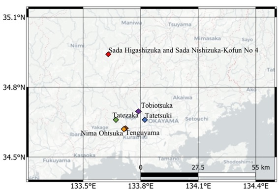
Map elaborated on QGIS for the phD research "Pot Shards". Six (6) Archaeological sites are indicated within the prefecture of Okayama: Tatetsuki (blue), Tatezaka (green), Nima Ohtsuka (yellow), Tenguyama (brown), Sada Higashizuka and Sada Nishizuka, both in red due to its short proximity. Tatetsuki and Tatezaka remains are from the Yayoi period (5th century BCE to 3rd century CE Historical) as the rest are from the Kofun period (3rd to 7th centuries CE).
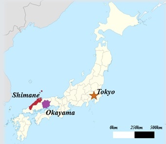
Map elaborated on QGIS for the phD research "Pot Shards". The provinces of Shimane and Okayama are displayed in red and purple respective, which the archaeological sites are located.